[PYTHON] Save Twitter's tweets with Geo in CSV and plot them on Google Map.
For the time being, I don't know how to narrow down the locale from the STREAMING API due to lack of knowledge. So I usually use Search to pick up "Nau" and "i'm at" and plot them.
-
- Create CSV data with the previously created Python script for Twitter search
- Map display in Javascript using GoogleMap API
-
- Plot there
I did it like that.
for tweet in tweets["statuses"]:
	User = (tweet["user"]["screen_name"].encode("utf-8"))
		try:
			Place = (tweet["place"]["bounding_box"]["coordinates"])

			flat_list = []
			for e in Place:
				flat_list.extend(e)

			flat_list2 = []
			for b in flat_list:
				flat_list2.extend(b)

			flat_list3 = []
			for c in flat_list:
				flat_list3.extend(c)

			geolng = flat_list3[0]
			geolat = flat_list3[1]
		except:
			pass
Well, like this, let's open only Place with try.
Place = (tweet["place"]["bounding_box"]["coordinates"])
If you fetch it with, the list will be nested, so use flat_list to cancel the nesting. No, it's not really beautiful ...
Export the acquired data as CSV and plot it on a map.
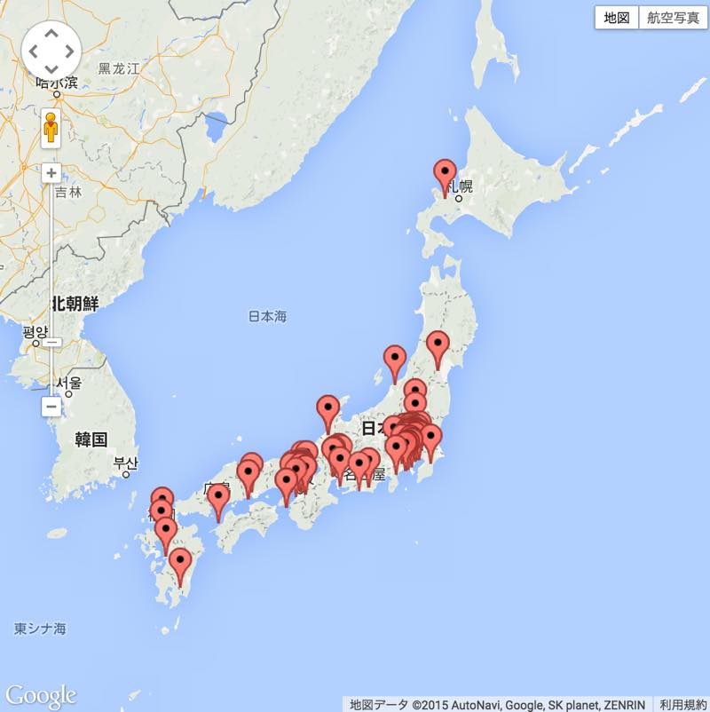
As expected, there are many metropolitan areas. Do local people not tweet with a lot of positions, or is the Twitter population itself small?
Oh, is the keyword to narrow down useless?